

ARES Map
GIS for CAD, CAD for GIS
Includes ARES Commander
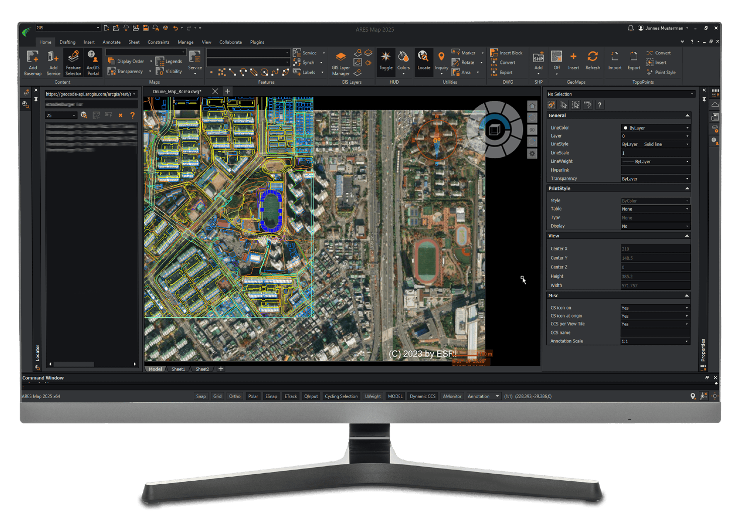
Complete CAD with GIS Enabled Features.
THE BEST OF BOTH WORLDS
ARES® Map™ brings together the intelligence of GIS (Graphical Information Systems) and world leading full-featured DWG-based CAD (Computer Aided Design). Maps and floorplans created with ARES Map are saved natively in DWG but can also contain smart GIS-enabled information associated to the entities.
Includes:
-
- ARES Commander – Windows desktop CAD
- ARES Kudos – Browser based DWG creation, editing and comment
- ARES Touch – Tablet and phone, editing and viewing
- ARES Cloud – Team collaboration services
- ARES Commander – Windows desktop CAD
For CAD Users
Enrich your DWG drawings with Professional Maps from Esri ArcGIS Online, the World leader for GIS solutions – ARES Map is the perfect companion to collect and convert CAD data to GIS and also modify information from CAD drawings. All the tools you need to make CAD meet the real world.
For GIS Users
ARES Map combines all the drafting tools of hi powered CAD with a familiar CAD interface to create and modify DWG drawings with ready to use maps and georeferenced information. Add GIS intelligence into your CAD drawings
Map Services
- Connect to Esri's map servers and add free base maps to your CAD drawings for any location on Earth: satellite images, street maps, topographic maps and more
- Map services can be saved and reloaded or exported as raster images in your drawing
- Locate: Search any place or address to get the exact maps you want
Coordinate Systems
- Add multiple maps and they will be positioned accurately with real-world coordinates
- Add a GIS coordinate system to any DWG drawing from a list of systems
- Choose from hundreds of projected, geometric or vertical coordinate systems
- If no coordinate system is assigned, ARES Map will assign automatically a default one based on the first GIS service loaded
Feature Services
- Locate: Search any place or address to get the exact maps you want
- Display the legend associated to a map service
- Manage the transparency and draw order of your maps to overlay or fade content
Attributes & Labels
- Feature services entities contain not only geometry, but also attributes that you can display and edit from ARES Map's properties panel
- ARES Map maintains the integrity of your GIS information. Attributes can only be modified following the attributes field definition and constraints defined by the GIS administrator: named values, range
- Labels help you annotate your drawings with text information extracted from the feature services attributes and stay in your drawing even when the feature service is not loaded
Convert CAD entities to GIS Entities
- Create empty ARES Map templates (DWT format) containing your favorite coordinate system, base maps and feature services
- Insert one or more DWG drawings and define their position in the real world using for example a base map
- Move selected entities to feature services and they will be recognized as GIS entities
- Unique conversion tool to assign all the entities of your CAD drawing to each feature class type and subtype
- Entities not qualifying for the feature service definition will be automatically rejected
- ARES Map always preserves the integrity of your GIS project following the schema defined by your feature services
Maximum Interoperability
- Log in to your ArcGIS Online account to load map and feature services and publish modifications
- Connect to any feature or map server via ArcGIS for Server
- Drawings created with ARES Map are saved natively in DWG, you can share them with users of ARES® Commander, AutoCAD® or other DWG-based CAD software
- By default, the feature services will not be visible in other CAD software to protect your information; but you may decide to use our GIS to CAD feature to convert them into pure DWG entities
- ARES Map's hybrid technology will help you create smart GIS-enabled entities that will be recognized by Esri solutions such as ArcGIS® for Desktop and ArcMap®
Try
A 30 Day Trial License
US$0
Buy
A license that auto-renews until you cancel.
US$931 / year
Save $$$
US$1,870 every 3 years
Includes:
-
- ARES Commander, Desktop – (Windows) with GIS Tools
- ARES Kudo, Cloud Based CAD
- ARES Touch, Tablet Based CAD
- All Software Upgrades
- Cloud Services.